Image
At Monday's meeting, Saline City Council began spending some of the more than $1,000,000 in grant funding the city acquired to build a river walk connecting US-12 with Mill Pond Park's Bennett Street parking lot.
Council voted 6-0 to approve a $63,200 professional services agreement with the Spicer Group. The company will provide grant administration, a topographical survey, geotechnical investigation, and design and bidding services. Their services are $13,000 more than expected due to reporting requirements attached to the $800,000 SEMCOG grant that makes the project possible.
City Engineer Tesha Humphriss estimated the project would begin in 2025.
Along with the $800,000 from SEMCOG, the project was boosted by $240,000 from the Washtenaw County Connecting Communities Program and $45,000 from the Community Foundation for Southeast Michigan.
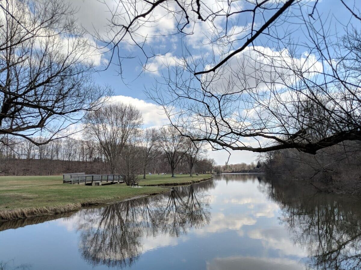
Mayor Brian Marl said he was excited to see the work begin - especially since the entire project was expected to be funded without impacting the city's general fund. Marl called Mill Pond Park "arguably" Saline's nicest park and said it was one of the nicest parks in the county.
"The Saline River and the Mill Pond are, in my judgment, some of our greatest natural assets in the community, and we haven't done historically as good a job as we could have done leveraging those. So that's the genesis for the Mill Pond River Walk," Marl said.
Marl hopes the project will improve people's experiences at the park. He said he recently walked his dog along the river in the park.
"I apologize for the expression, but it sucked. The topography is beautiful, especially in the spring, summer, and fall, but it is so wet and really quite difficult to traverse. So, I'm excited to see that we're taking the next step and I think it will be a phenomenal addition to the community circa 2026 when this project is complete," Marl said.
But despite the excitement over the project - some realities present challenges.
One of those realities is the soil. Humphriss said the city had conducted three borings and one validated her concern about the land. She said the organic content in the soil showed it was unlikely that the land would support even a non-motorized path. The borings led city officials to expect more settling in recent years. Aerial photos studied by Humpriss showed much of the swamp land in the area was replaced by grassy land near the dog park today. She said most of that land is fill - likely excavated during the construction of the Saline Hospital.
"That’s the bad soil we shouldn’t be putting asphalt on top of," Humphriss said.
So when the river walk is built, it may not be as close to the river as expected. Instead, it may be a little closer to the tree line, where the land is "higher and drier."
There's another reason for that.
No one knows where the river will be in 2026 and years beyond.
City Council has considered the future of the dam that contains Mill Pond. Councillor Janet Dillon asked how discussions about the dam's future play into this project.
"Building a path along the side of a river which may no longer be there seems counterproductive," Dillon said.
However, Humphriss said, action on the dam is still "many, many, many years in the future."
In an eye-opening statement, Humphriss stated that she anticipates the dam will fail its inspection in 2026.
"And that's what's really going to require us to get really serious about it," Humphriss said.
So, there's another reason to move the river walk a little further from shore.
(Note, after publication, City Manager Colleen O'Toole provided this context about the expectation that the dam will fail its inspection:
EGLE is currently in the process of adopting updated regulations that will account for larger storm events and increased spillway capacity requirements. The City received confirmation in January that the updated regulations will not apply to our 2023 inspection. Assuming they are adopted at some point though, those new regulations would impact our 2026 inspection. If that were the case, our existing spillway capacity would not meet their requirements.)
In addition, the river walk path is very similar to the path for the west belt sewer, which will be improved in 2025.
Councillor Dean Girbach, concerned about the potential for "ripping up" a river walk soon after it was built, asked about staging these projects. Girbach said the sewer project was the higher priority.
Humphriss agreed. She noted that the plan is to complete the west belt sewer upgrade before the riverwalk project begins.
Grant language requires funds be obligated by the fall of 2024.
"The coordination (of these projects) needs to be tight," Girbach said.
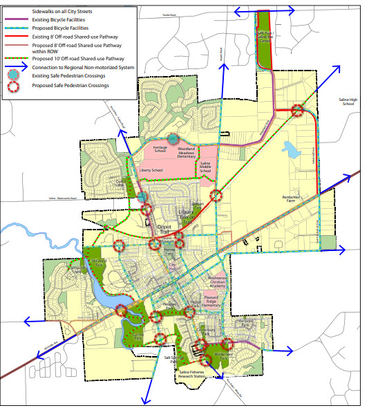
The river walk is just part of what's planned for Saline in the coming years, in terms of non-motorized paths. The master plan also shows the path connecting to Curtiss Park, via a proposed safe pedestrian crossing. The Curtiss Park trail would connect to People's Park. Another portion of the path would connect to Salt Springs Park and then to Wilderness Park. North of the park, plans show the paths behind Brecon Village and also traveling east toward the Depot Trail, and then connecting to a proposed path along the railway toward Saline High School.
But, as Humphriss said, talking about the plan's proposed path north of the park, "they're just lines on a map."


Patchy rain nearby, with a high of 71 and low of 44 degrees. Sunny during the morning, patchy rain nearby for the afternoon and evening, clear overnight.


Off you go first thing into the world of more government control. Government run power systems shouldn't even be on your mind. DTE is a private company, government regulated. Even that is ripe for corruption. How is the government run water monopoly doing? Think of Flint, Michigan and even little Saline.
Apart of the book of Revelation. We are living in it

To the editor ✍️
Please report out who said what accurately.
Is there something wrong with the current setup?
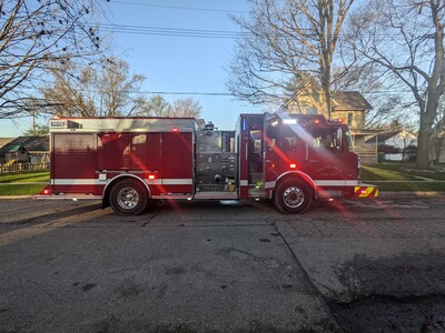
The fire department is receiving hundreds of thousands if not over a million in new equipment in conjunction with the data center project. Would think that save would have freed money at some point in the budget projections. More to the point, we have heard the Fire Chief speak two or three times now.