

Image
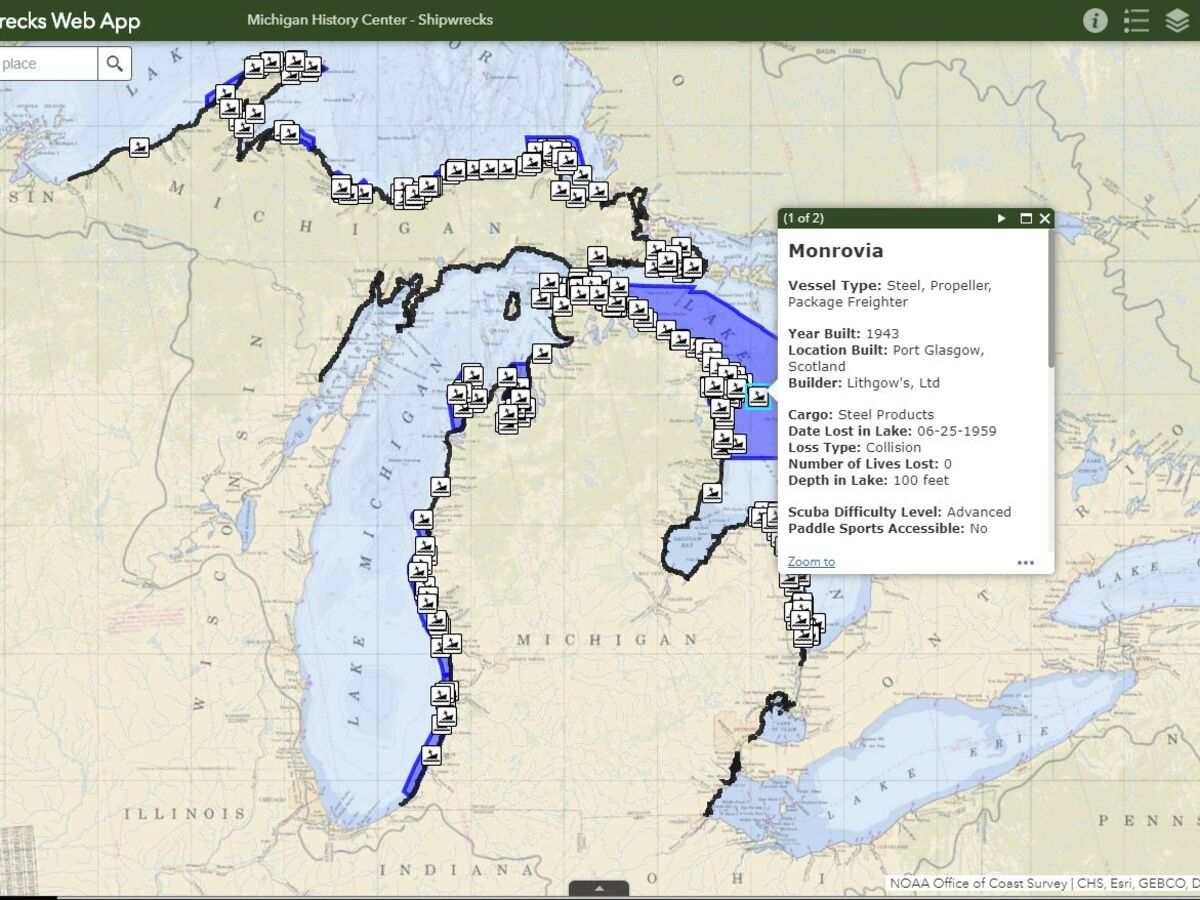
Some wrecks, such as the wooden bulk freighter Daisy Day, lie in as little as 10 feet of water and are suitable for beginning divers and visible to paddlers and snorkelers.
Others, such as the Indiana, a propeller vessel that went down in Lake Superior in 1858, are in more than 100 feet of water and require advanced diving skills.
The map will be updated as more ships are discovered and more information becomes available.
Users may notice that some high-profile wrecks, such as the Carl D Bradley, which sank in Lake Michigan in November 1958, are not listed. Because crew members went down with these ships, they are considered underwater burial sites.
Clark reminds the public that Michigan law prohibits removal of any artifacts from shipwrecks.
“The wrecks on the Great Lakes bottomlands belong to the people of Michigan,” she said. “If everyone follows the rule of ’take only pictures and leave only bubbles,” we can ensure that these underwater time capsules will be available for future generations to explore, research and enjoy.”
Visit and explore both the storymap and public web app at Michigan.gov/ExploreShipwrecks.


Sunny, with a high of 84 and low of 49 degrees. Sunny for the morning, clear overnight.


Could a republican possible win as mayor in Saline? Or did Ann Arbor move its woke agenda south to Saline?
“Yeah, empathy and treating people decently has really gotten out of hand.” Your maga brand keeps getting more corrupt by the day.
I look forward to sharing my hard work with the woke agenda.... that is why I worked to hard to share. Sharing that BIDEN love of corruption that he so promoted with his crooked Doctor JILL. So you voted for WORD SALAD? Hope she runs again TRUMP 2028!