
Image
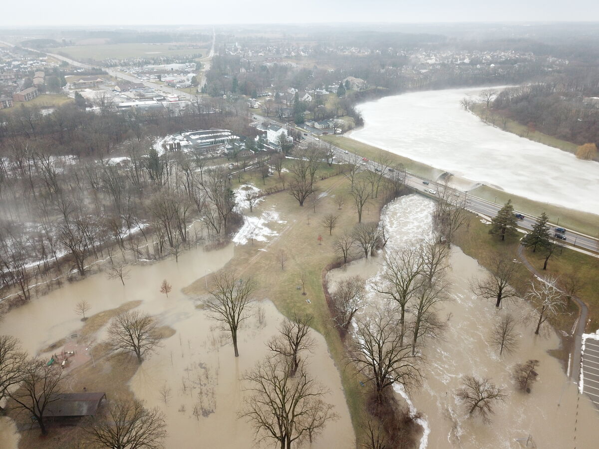
Rising temperatures melted what was left of the snow. The melted snow and three inches of rain overwhelmed drains and ditches and flooded Mill Pond Park and Curtiss Park.
The dam at Mill Pond Park was raised to allow runoff, which caused substantial flooding in Curtiss Park. The City of Saline barricaded the entrance of the park to prevent motor vehicles from entering.
Another 1-2 inches of rain is possible Wednesday morning. A flood watch remains in effect until 4 p.m.
So far, according to data posted on the National Water Information System website, the water level is as high (11.17 feet) as it has been since 2012, when it hit 11.78 feet. The highest on record was June 26, 1968, when the water level reached 13.37 feet. That was the day after the dam broke at Mill Pond.
The rain is expected to stop by 1 p.m. Temperatures are also dropped to around 39 degrees by 9 a.m. Wednesday night, the low will be around 27.
A look at the flooding of Curtiss Park in Saline Michigan today pic.twitter.com/gmhoyyxKv3
— TheSalinePost (@TheSalinePost) February 21, 2018


Partly Cloudy , with a high of 43 and low of 26 degrees. Overcast in the morning, sunny in the afternoon, clear overnight.